
For Henderson County neighbors
The Henderson County Food Finder is live with the Community Foundation of Henderson County: a free map of every verified food resource in the county.
A simple way to find food assistance near you: locations, hours, and what each provider offers.
Una forma sencilla de encontrar asistencia alimentaria cerca de usted.
Find food near youFor conveners & funders
See where the need is. Coordinate the response.
A community foundation board asked how they’d know they were funding the most impactful things around food. They get more requests than they can honor. FastRoots is what came of that question: every charitable food location in a county confirmed by a person, kept current by a person, and a public map the county uses.
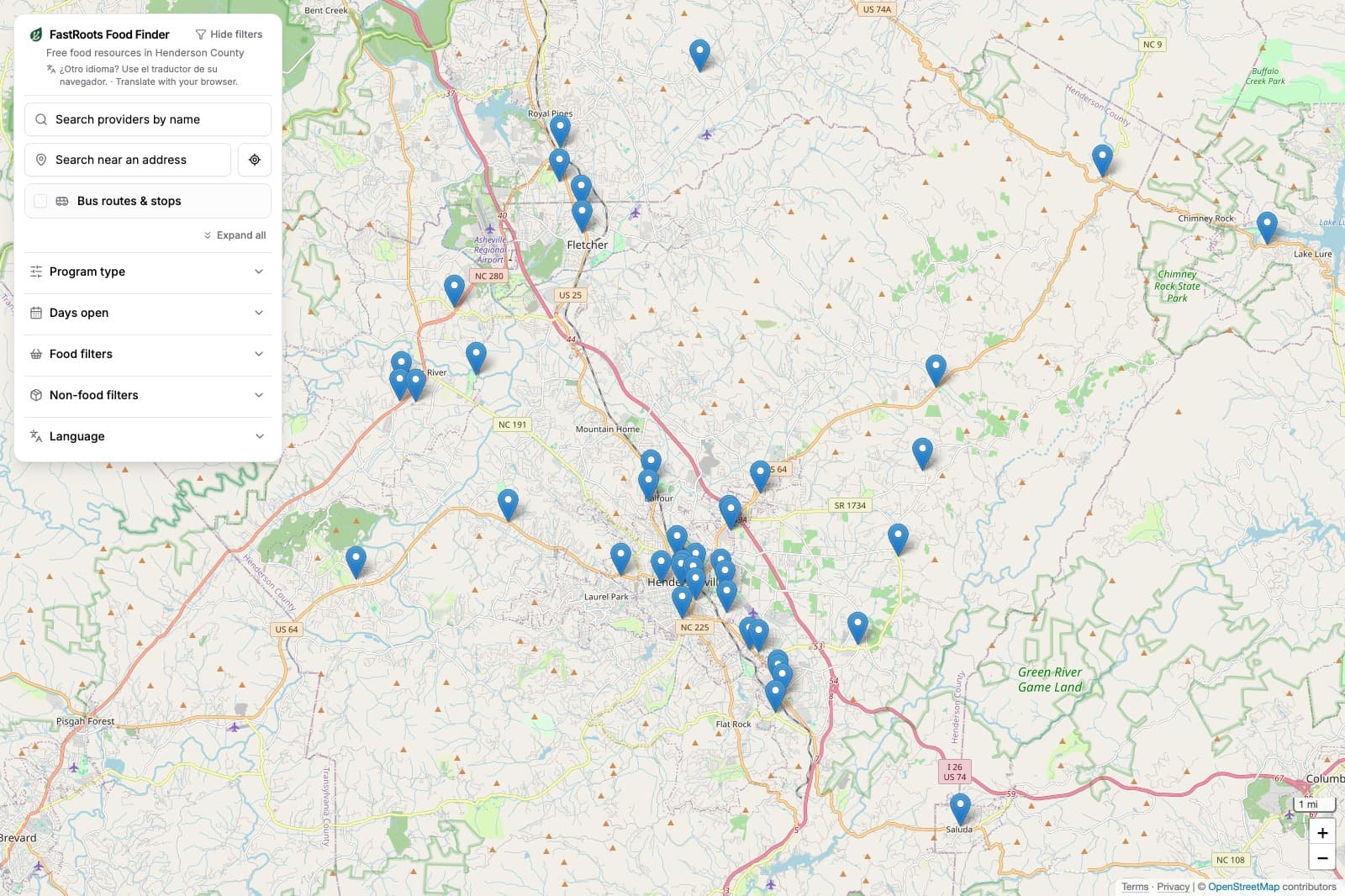
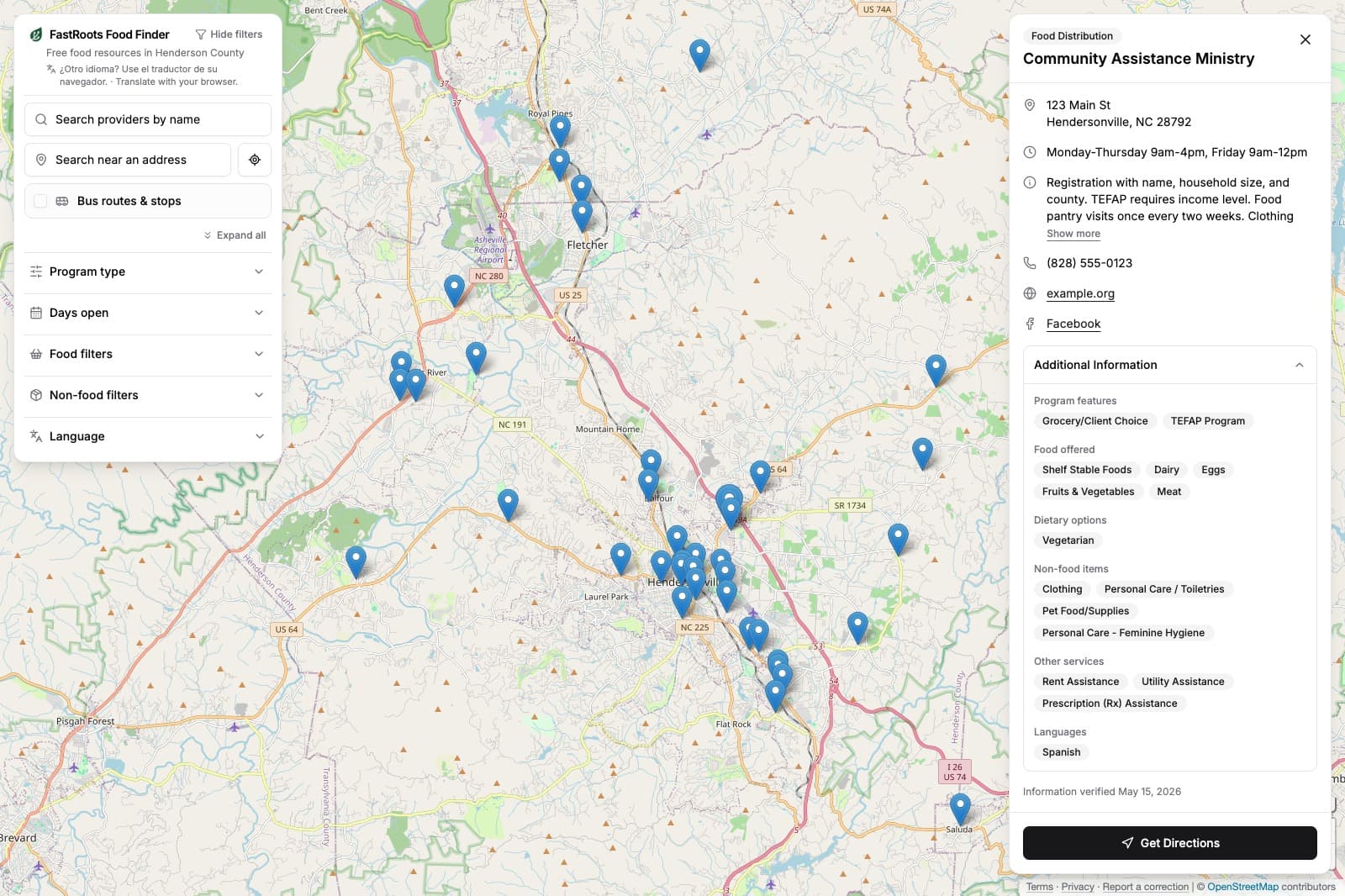
The public map your community uses
National platforms tell you a pantry exists. FastRoots tells you whether it was open last Tuesday, who it served, and what need it couldn’t meet, because someone who lives there picked up the phone.
Verified, not just mapped.
Most counties have several lists of where to get food: the 211 entries, the regional food bank’s partner map, a PDF guide, a church directory, a volunteer map. Each one was right the day it was made. FastRoots builds one list from all of them, then keeps calling.
Step 1
We build your county’s verified data
Every charitable food location in the county, reached by phone, and in person when a call can’t settle it. Each pantry hands out its own list, so the first round is one conversation at a time.
Step 2
We keep it alive
Pantries are mostly run by volunteers who don’t update 211 or the food bank finder. So every location is re-verified in full rounds, on a recurring schedule, by a person who calls back.
Step 3
You put it to work
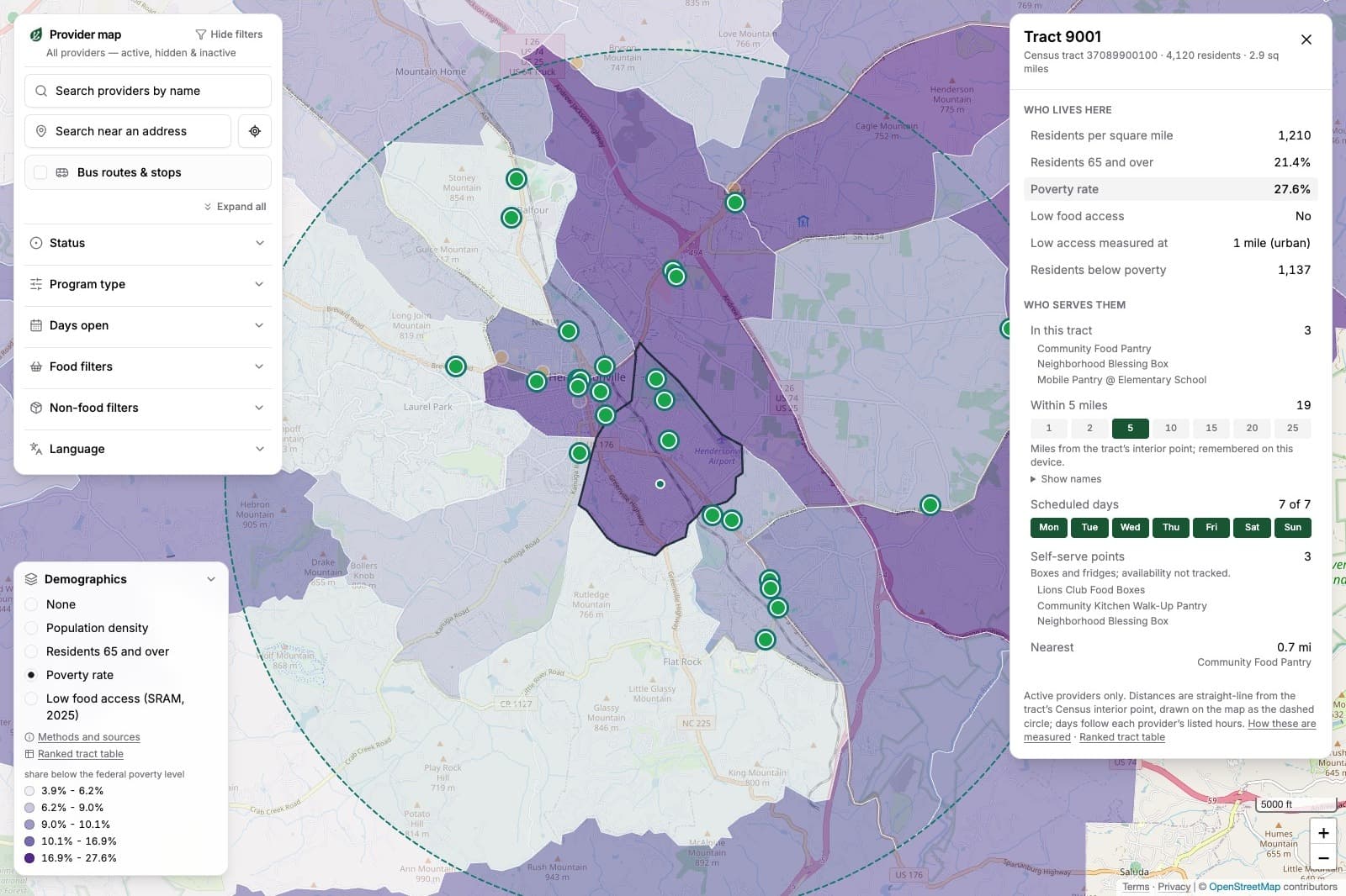
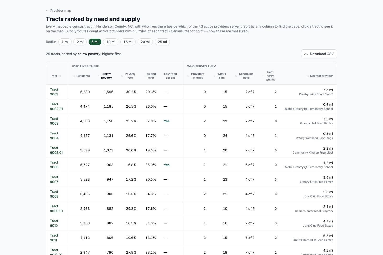
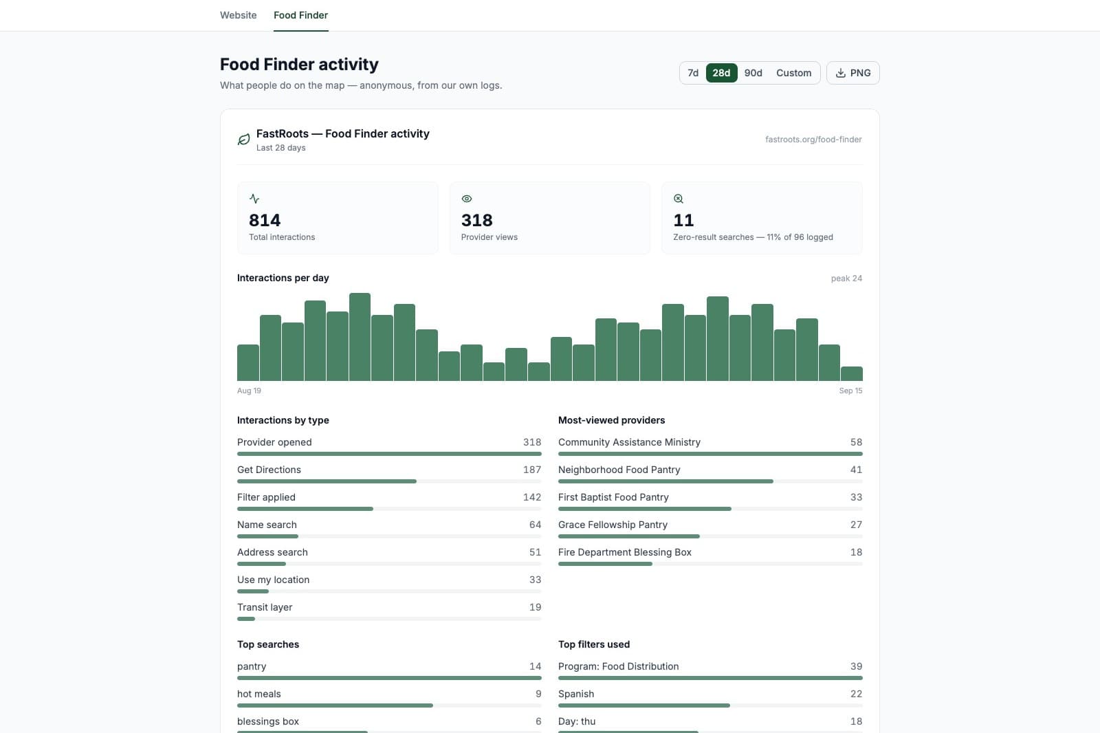
When a grant request comes in, staff open the same provider data laid over census-tract poverty, age, and USDA low-access layers. The public map also keeps a tally of where people searched and nothing came back, at the tract level, with no one’s address stored.
Step 4
Your community gets the map
A public Food Finder in your county’s name. Free, no account, in English and Spanish.
Built for whoever convenes your region
Community foundations and health foundations
One verified picture of the county that the board, grant partners, and donors all look at.
Food councils & coalitions
The list every member keeps separately, kept once, with the county’s need layers underneath it.
Health departments & United Ways
Verified referral data for CHNA work and 211-adjacent programs.
Hub nonprofits
The PDF resource guide you print every year, as a living map you can cite in your own grant applications.
The other side of the grant table asked first.
Several charitable food organizations have asked about using Food Finder data to make their case in grant applications and show unmet need in their part of the county. No funder required it of them. When applicant and funder read from the same verified picture, the question changes from whether the need is real to whether this is the right response.
Read Both Sides of the Grant Table in Field NotesProven in the field
Henderson County, North Carolina
Henderson County: every location, reached twice, map open since September.
With the Community Foundation of Henderson County, every charitable food location in the county was reached by phone, and in person when a call couldn’t settle it, first in late 2025 and again in May 2026. The public Food Finder opened September 16, 2026 with 43 active locations and 449 visits on its first day. The third round is running now, and the community foundation is bringing in regional co-funders at a set amount each.
“FastRoots compiled detailed profiles on all food assistance providers across Henderson County through direct outreach, including church pantries and programs that operate independently. It’s the most complete picture of our food relief ecosystem we’ve ever had, and our board and committees now use the interactive map to better understand the needs landscape of our area.”
Hurricane Helene relief coordination
Three organizations, 12-county Western NC region
45
Relief centers mapped
12
Counties covered
106K+
Meals & food boxes
1st
Regional impact report
“Instead of working in silos, the grantee organizations used shared data to coordinate distribution. It’s a model we hope to see in future recovery grants.”
Built to last on community-scale funding: not on a waiver, a grant cycle, or a state budget line.
Common questions
We already have a resource guide / Google Map / ArcGIS map.+
Good. Send it over and we start from it. In the one county we’ve built so far, the lists that existed before the first round didn’t all name the same places.
How is this different from Findhelp, 211, or Feeding America’s finder?+
National directories list around a million programs and review listings on multi-month, self-reported cycles. A regional food bank’s finder lists the pantries that partner with it, and each partner keeps its own entry current. FastRoots works one county at a time. Every location is spoken with in each round, by phone, and in person when a call can’t settle it, and the person calling asks what a directory never asks, like what the pantry couldn’t keep up with since the last round.
How is this different from a needs assessment or mapping study?+
An assessment tells you what was true the year it was written. This is re-verified in every round, used daily by neighbors and staff, and the search tally grows every month. Already have an assessment? Send it over. We’ll load it as the starting point and show you what’s changed since.
Who keeps the data current?+
A person who calls every location in scheduled rounds, with providers able to update their own listing between rounds.
How does this help us raise money?+
Grant partners have asked to cite the need layers and the empty-search tally in their applications. Development staff put the live map in front of donors and fund holders. One incremental grant or gift covers a county’s annual cost.
What does it cost?+
An anchor sponsor (usually a community foundation, coalition, health department, or county government) funds a county, and regional co-funders join at a set amount each. Providers never pay to be listed or verified. Tell us your county and we’ll talk specifics.
Is this only for food?+
Food is where we start because it’s the lowest-barrier signal of household distress. The same verified data extends to housing, benefits enrollment, utility assistance, and family services.
Tell us your region.
If we’re building near you, we’ll show you the region live. If we’re not, founding sponsors choose where we go next. Send your county’s food bank partner list and whatever else neighbors use to find food, and we’ll tell you what we see.